AUAV specialises in providing cutting-edge drone solutions for inspecting transmission lines and towers. Our advanced technology ensures the safety, efficiency, and accuracy of inspections, offering significant advantages over traditional methods. With years of experience working with major utility providers, we deliver high-quality data and actionable insights to help maintain critical infrastructure.
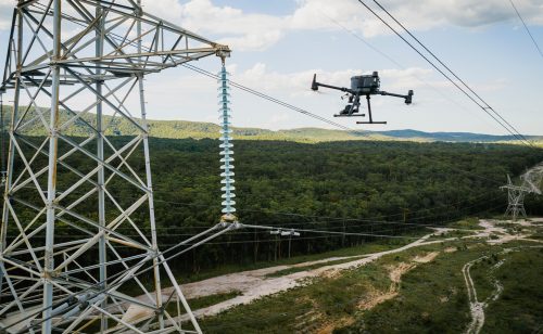
Transmission Line & Tower Inspections
Why Choose AUAV for Transmission Line & Tower Inspections?
Enhanced Safety
Traditional methods often involve hazardous climbs or proximity to live wires. With drones, we eliminate the risks associated with manual inspections, protecting both workers and infrastructure.
Increased Efficiency
Drone-based inspections significantly reduce the time required for site assessments. Our UAV systems can cover large areas quickly, minimising downtime for your assets.
High-Resolution Imaging
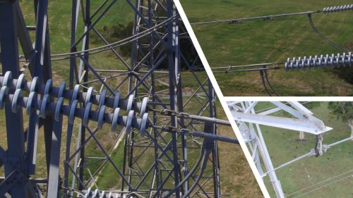
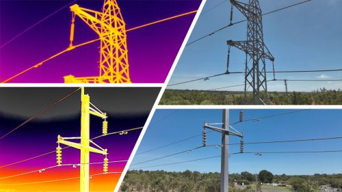
Using full-frame sensors, our drones capture high-resolution imagery and videos of transmission lines and towers. This enables precise defect identification, such as corrosion, wear, or vegetation encroachment.
3D Modelling & Digital Twins
We create high-resolution 3D models of towers and lines, providing a detailed digital twin for monitoring and maintenance planning.
LiDAR for Line Clearance & Corridor Mapping
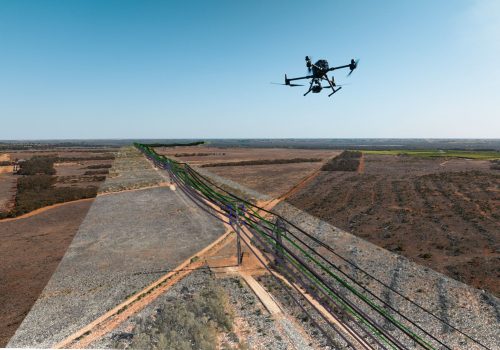
Equipped with advanced LiDAR sensors, our drones capture detailed 3D data of the entire transmission corridor. This includes:
1.Accurate clearance measurements between lines, vegetation, and nearby structures.
2.Comprehensive terrain mapping for route optimisation and infrastructure planning.
3.Vegetation encroachment analysis to ensure compliance with safety regulations.
Thermal Imaging for Hotspot Detection
Thermal cameras detect hotspots caused by issues like loose fittings, enabling proactive repairs and reducing the risk of equipment failure.
Our Services
Routine Inspections
Periodic drone inspections to monitor the condition of towers, insulators, and conductors.
Emergency Inspections
Quick deployment of drones to assess storm damage or outages, ensuring rapid restoration of services.
Vegetation Management
Precise mapping of vegetation encroachments to plan and prioritise trimming activities.
Corridor Mapping & Analysis
High-accuracy LiDAR and photogrammetry solutions to map and analyse transmission line corridors. This includes digital elevation models (DEMs), topographic mapping, and detailed reporting of environmental constraints.
Defect Mapping
Identification and reporting of structural issues, such as cracks, corrosion, or loose components, with detailed geotagged reports.
AUAV’s Expertise in Utility Inspections
At AUAV, we are committed to leveraging drone technology to provide unparalleled inspection and mapping services. Our team of certified pilots, LiDAR experts, and data analysts ensures that every project is executed with precision and professionalism. With our solutions, utility providers can optimise maintenance schedules, extend asset lifespans, and ensure compliance with industry regulations.
Contact Us Today!
Ready to enhance your transmission line and tower inspections? Get in touch with us to learn how our drone technology can help you maintain safe, reliable, and efficient infrastructure.
