Why Drones are Revolutionising Survey Projects in Australia
Imagine standing at the edge of a vast expanse of land, trying to gather precise measurements and data using traditional survey methods. It’s slow, costly, and often riddled with errors. For years, this has been the reality for land developers, environmental scientists, and agricultural professionals alike.
But what if you could access that data faster, more accurately, and at a fraction of the cost?
Welcome to the world of drone surveying in Australia, a game-changer in how we map, measure, and plan our projects. The desire for efficiency and accuracy, paired with the frustration of outdated techniques, has led to the rise of drone land surveying across various industries. This cutting-edge technology not only saves time but also provides insights that were once impossible to achieve.
If you’re planning a new residential development, monitoring endangered species, or managing vast farmlands, aerial surveys using drones are transforming the way we approach survey projects.
But what are the top applications of drones for surveying in Australia, and why should you consider them for your next project? Let’s get into it.
Looking for reliable and efficient drone surveying services? Contact us today to discuss your project needs.
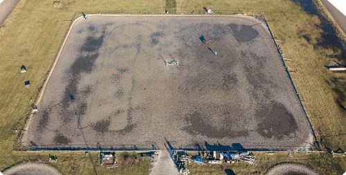
Land Development and Urban Planning
Urban growth is a double-edged sword: it’s essential for progress but can lead to unplanned chaos if not managed correctly. Drones for survey have become indispensable tools for architects, developers, and planners. They provide high-resolution imagery and accurate topographical maps that help design smarter cities and communities.
Using drone mapping solutions, professionals can assess land conditions, identify potential challenges, and streamline the approval process with government agencies. This technology also aids in infrastructure development by offering precise data for roads, bridges, and utilities. Imagine cutting down months of manual surveying work into just days, all while improving the quality of your decisions.
Key Benefits:
- Rapid data collection for large areas.
- Cost-effective compared to traditional survey methods.
- Enhanced collaboration with accurate and detailed visualisations.

Environmental Monitoring and Wildlife Management
Australia’s diverse landscapes and unique ecosystems make environmental conservation a priority. Traditional methods of environmental monitoring often disrupt the very habitats they aim to protect. This is where aerial mapping comes in.
Drone surveying in Australia allows researchers to monitor wildlife populations, track migration patterns, and identify environmental threats without disturbing the ecosystem. For example, drones can be used to survey bushfire-affected areas, helping authorities assess damage and plan recovery efforts. Similarly, coastal erosion and water quality monitoring become significantly more manageable with aerial survey mapping drones.
Key Benefits:
- Non-invasive data collection.
- Real-time insights into changing environmental conditions.
- Accessibility to hard-to-reach or dangerous areas.
Agriculture and Forestry Land Surveys
Farmers and forestry managers are always looking for ways to optimise their operations. Drone mapping offers precise insights into soil conditions, crop health, and forest management. By using drone survey mapping solutions, farmers can identify irrigation needs, detect pest infestations, and maximise yields.
In forestry, drones help map tree density, monitor reforestation projects, and assess timber volumes. These capabilities not only improve productivity but also contribute to sustainable resource management. Australian aerial mapping ensures that even the most remote agricultural and forestry projects can be monitored with ease.
Key Benefits:
- Targeted solutions for improving crop and forest health.
- Reduced resource wastage through precise data analysis.
- Increased sustainability through informed decision-making.

Mining and Resource Exploration Mapping
Mining and resource exploration are critical to Australia’s economy, but they often come with logistical and safety challenges. Aerial survey using drones is now a preferred method for mapping and exploration. By deploying drone mapping solutions, mining companies can survey vast areas, identify mineral deposits, and plan extraction processes efficiently.
Drones can also be used to monitor site progress, assess environmental compliance, and ensure worker safety. The ability to gather accurate, real-time data from dangerous or inaccessible areas makes drone surveying a valuable tool for resource management.
Key Benefits:
- Improved safety by reducing the need for on-site surveys in hazardous areas.
- Faster identification of resource-rich zones.
- Enhanced environmental compliance through precise mapping.
Why Choose a Professional Drone Survey Company for Your Next Project?
While drones are undeniably powerful, their true potential lies in the expertise behind the controls. Hiring a professional drone survey company ensures that you receive accurate, reliable, and actionable data tailored to your project’s needs.
Professionals bring advanced equipment, software, and the experience to handle complex survey requirements. They also understand local regulations, ensuring compliance with Australian aviation laws. By working with experts, you’re not just investing in technology; you’re investing in results.
Explore our tailored drone survey solutions for land development, agriculture, mining, and more. Get a free consultation now.
Benefits of Hiring Expert Drone Survey Companies
- Accuracy and Reliability: Professionals use advanced drone mapping solutions and data processing software to deliver highly accurate results.
- Time Efficiency: With expert operators, survey timelines are significantly reduced without compromising quality.
- Regulatory Compliance: Professionals navigate Australia’s complex aviation regulations, ensuring a seamless process.
- Customised Solutions: Every project is unique, and experts can tailor their services to meet specific requirements.
How to Evaluate a Drone Survey Provider in Australia
Choosing the right drone survey company is crucial for the success of your project. Here are some factors to consider:
- Experience and Portfolio: Look for companies with a proven track record in your industry.
- Equipment and Technology: Ensure they use advanced drones and software for aerial survey and mapping.
- Compliance: Verify their adherence to Australian Civil Aviation Safety Authority (CASA) regulations.
- Customer Reviews: Check testimonials and case studies to gauge client satisfaction.
- Cost Transparency: Ensure there are no hidden fees and that the pricing aligns with the value provided.

Cost Breakdown of Drone Survey Services
While the cost of drone survey mapping solution varies depending on the project’s scope and complexity, it generally includes:
- Initial Consultation: Understanding project requirements and objectives.
- Data Collection: The actual surveying process using drones.
- Data Processing: Converting raw data into actionable insights using specialised software.
- Reporting: Delivering results in formats such as 3D models, orthomosaics, and elevation maps.
Although upfront costs may seem higher than traditional methods, the long-term savings in time, accuracy, and efficiency often outweigh the initial investment.
Common Challenges in Drone Surveying and How Professionals Address Them
While drones offer numerous advantages, they are not without challenges. These include:
- Weather Conditions: Strong winds or rain can disrupt flights. Professionals schedule surveys during optimal conditions to ensure quality data.
- Regulatory Hurdles: Navigating CASA regulations requires expertise. Certified operators handle permits and compliance seamlessly.
- Data Overload: Large projects generate vast amounts of data. Professionals use advanced software to process and analyse this efficiently.
By choosing a qualified drone survey company, you can rest assured that these challenges will be effectively managed, ensuring your project stays on track.
Ready to Transform Your Project with Drone Surveying?
Australia’s landscape is as diverse as its industries, and drone technology is helping us manage it more efficiently than ever before. From urban planning to environmental conservation, aerial survey using drones is the key to unlocking accurate, cost-effective, and sustainable solutions. So why wait? Start your journey into the future of surveying today with AUAV.
Ready to experience the benefits of aerial mapping? Reach out to us for a customised quote on your next survey project.