You’re a city planner staring at outdated maps, struggling to visualise the ever-changing urban sprawl; or maybe an environmentalist unable to grasp the full extent of deforestation from ground-level reports. We understand the frustration is real, the stakes are high, and the solutions have long been limited. But now, picture a world where every inch of the landscape is captured in stunning detail from above, providing insights that were once unimaginable.
Welcome to the era of aerial mapping—a revolution quietly reshaping industries across Australia.
From cityscapes to coastlines, the ability to map, analyse, and respond to our world with unprecedented precision has definitely changed the game. At the heart of this transformation is drone land surveying, an innovative technology that’s not just about flying cameras but about smarter decision-making.
But how is aerial mapping truly making a difference? Why are industries racing to collaborate with drone survey companies to access cutting-edge drone mapping solutions? And most importantly, how can businesses, governments, and individuals in Australia harness this innovation to solve problems that once seemed insurmountable?
Let’s get into how aerial mapping is reshaping urban planning, environmental monitoring, disaster recovery, and beyond—while exploring the technologies driving this remarkable shift.
Curious about how aerial mapping can benefit your business?
What are the main benefits of using aerial mapping for urban planning?
Urban planning in Australia has faced mounting challenges: rapid population growth, limited land resources, and the need for sustainable development. Traditional methods of mapping and surveying often fall short in providing the level of detail and accuracy required.
Aerial mapping changes the game by offering high-resolution imagery and 3D models of urban areas. With drone survey mapping solutions, city planners can analyse infrastructure, identify land use patterns, and optimise zoning with incredible precision. Imagine planning new transport routes without disrupting existing neighbourhoods or mapping future residential developments while reducing environmental impact.
Drone mapping solutions in Australia enable planners to visualise the terrain like never before, helping create smarter cities that cater to growth while maintaining liveability. This isn’t just about saving time—it’s about making better decisions that benefit millions of Australians.
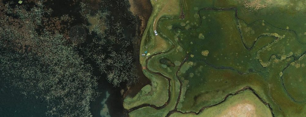
How does aerial mapping contribute to environmental monitoring in Australia?
Australia’s diverse ecosystems are both a treasure and a responsibility. From the Great Barrier Reef to vast bushlands, preserving these environments is critical. Aerial survey technology provides a bird’s-eye view of our natural world, helping environmentalists track changes, assess damage, and implement conservation strategies.
Drone mapping excels in environmental monitoring by capturing data on deforestation, water resource management, and wildlife habitats. Unlike traditional methods, drones can access remote or hazardous areas without disturbing the ecosystem. For instance, monitoring coral bleaching or mapping the spread of invasive plant species becomes significantly more efficient and accurate with drones.
By using drone mapping solutions, Australia is better equipped to combat climate change, protect endangered species, and maintain its unique biodiversity for future generations.
Exploring Drone Mapping and Its Impact on Modern Cartography
For centuries, cartography was limited by human capacity and technology. Today, drones are rewriting the rules. Drone mapping brings unparalleled precision to modern cartography, capturing real-time data that’s detailed and dynamic.
Drone survey companies in Australia are at the forefront of this transformation, creating maps that serve industries ranging from agriculture to mining. These maps aren’t just static representations; they’re tools for analysis, planning, and action. Farmers use them to optimise crop yields, while mining companies rely on them for resource exploration and site management.
The impact of drone mapping on cartography is profound. It democratises access to high-quality mapping, reduces costs, and opens up new possibilities for industries that depend on accurate geographical data.
What sets drone mapping apart from satellite mapping?
While both drone and satellite mapping offer valuable insights, they are fundamentally different in terms of resolution, flexibility, and application. Satellite imagery provides large-scale overviews but often lacks the detail and immediacy required for many projects.
Drone mapping, on the other hand, offers:
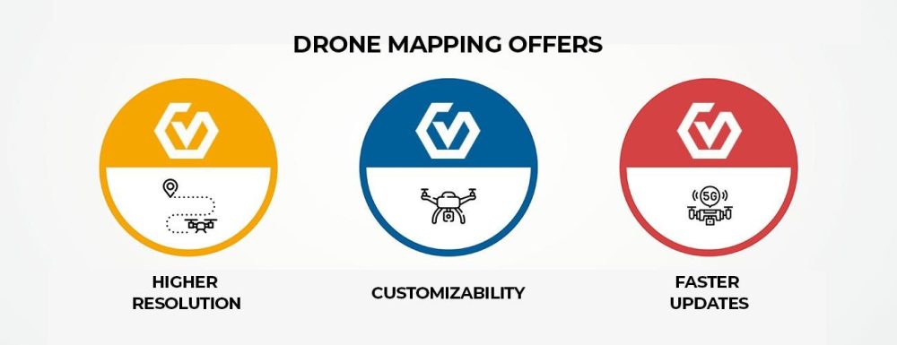
- Higher Resolution: Drones fly closer to the ground, capturing finer details. This is particularly useful for infrastructure inspections or small-scale projects.
- Customizability: Drones can be deployed on-demand and tailored to specific areas of interest, unlike satellites that follow pre-set orbits.
- Faster Updates: Drones provide real-time data, essential for industries requiring up-to-the-minute insights.
For Australian industries, these advantages make drone mapping solutions a clear choice for projects requiring precise and actionable data.
Ready to start your next project?
How can drone mapping be used for disaster response and recovery efforts?
When disasters strike, every second counts. Floods, bushfires, and cyclones have long plagued Australia, and traditional response methods often struggle to assess the full scope of damage quickly. Drone mapping offers a lifeline.
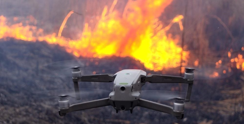
In disaster response, drones provide real-time aerial surveys of affected areas, allowing emergency teams to identify the hardest-hit regions and allocate resources effectively. They can map inaccessible zones, track the progress of recovery efforts, and even assist in search-and-rescue missions.
For example, during bushfires, drones can map fire boundaries, helping firefighters plan containment strategies. After floods, aerial mapping enables authorities to identify infrastructure damage and prioritise repairs. The speed and accuracy of drone mapping can save lives and accelerate recovery, offering hope when it’s needed most.
What future technologies could redefine aerial mapping in Australia?
The future of aerial mapping is as exciting as its present. Innovations on the horizon promise to push boundaries even further, enabling applications we’ve yet to imagine.
Some of the technologies likely to shape aerial mapping in Australia include:
- AI-Powered Analysis: Artificial intelligence will transform raw mapping data into actionable insights faster than ever before.
- Swarm Drones: Coordinated fleets of drones could cover vast areas simultaneously, improving efficiency for large-scale projects.
- Enhanced Sensors: Advanced imaging technologies, such as hyperspectral cameras, will unlock new ways to analyse terrain and resources.
- Autonomous Mapping Systems: Drones capable of self-navigation will reduce human intervention, making aerial surveys even more cost-effective.
As these technologies develop, Australia’s industries stand to benefit immensely, solidifying the country’s position as a global leader in aerial mapping innovation.
How do advancements in drone technology enhance mapping accuracy?
Accuracy is the cornerstone of aerial mapping, and advancements in drone technology continue to raise the bar. Modern drones are equipped with cutting-edge GPS systems, high-resolution cameras, and advanced stabilisation mechanisms, ensuring that every detail is captured with precision.
In Australia, industries like construction, mining, and agriculture rely heavily on drone mapping for precise measurements and site assessments. Enhanced accuracy reduces errors, lowers costs, and improves project outcomes.
Drone mapping solutions Australia offers today are capable of producing 3D models and orthomosaic maps with sub-centimeter accuracy, a feat unimaginable a decade ago. With ongoing improvements, the accuracy and reliability of drone mapping will only continue to improve.
Where to Begin with Drone Land Surveying
If you’re ready to experience the transformative power of aerial mapping, it’s essential to partner with a trusted drone survey company. Look for experts who understand the unique challenges of Australian terrain and offer tailored drone mapping solutions to meet your needs.
From urban planning to environmental conservation, the possibilities are vast with AUAV. Don’t wait to discover how aerial mapping can revolutionise your industry.
Want to see the difference aerial mapping makes? Request a demo from our expert team.

